BUY NOW

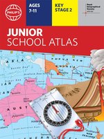
Maybe you’ve looked at a globe and been amazed by the sight of all the world’s countries. But did you know that maps can show you much more than just where places are? Landscape, population, industries, transport, tourism: maps can illustrate all these things. Clever, huh? Now this handy book shows you a huge range of maps, giving you all the skills you need to read them. Take a close-up look at the UK and Ireland. What cool stuff is right on your doorstep? Then check out all your must-see global destinations. The maps in here will be your guide… The market-leading atlas for National Curriculum KS2 Clearly explains different map types, scale and symbolsCovers topics including climate, industry, transport and energy22-page section for the UK and Ireland, including regional mapsPolitical and physical maps, plus an overview of each continentPublished in association with the Royal Geographical SocietySupplied as a pack of six copies.
£49.00
BUY NOW
